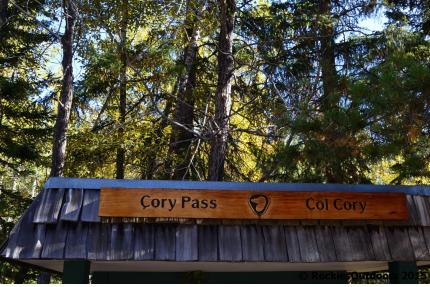
If you look in the Parks Canada guide to hikes in the Banff Area, Cory Pass Loop is described as ‘the most strenuous day hike in the Banff Area’. It’s true the hike does take a fair while to do and it is very much an uphill struggle for the first section of the hike. But if you have the time and the enthusiasm it is a worthwhile hike to do.
The trailhead is at the Fireside Picnic Area just on the Bow Valley Parkway – when I did the hike we cycled along the Legacy Trail from Banff which took about 15 minutes or so from downtown.
The trail starts out fairly flat for a very short section and then the climb begins! There are a lot of switchbacks going up and some sections where the trail just heads straight uphill. It seems best to make lots of water and snack breaks as this section is such a slog, but you’ll get there in the end!
Once you’ve done the steepest section of the climb up, there’s a short down section and then a more gentle climb up to Cory Pass. From this short downhill section to the summit of Cory Pass does take a fair while as you slowly climb out of the forest and into the alpine.
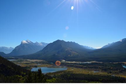
On the climb up to the pass there a great views over the Bow Valley – particularly over the Vermilion Lakes, and towards Sulphur Mountain and Mount Rundle.
We stopped at the summit of Cory Pass to enjoy our lunch and then take some photos. Even though it was a sunny day it was pretty windy up there so it’s a good idea to bring some spare layers. From here you’ll be able to see Mounts Cory, Edith and Louis.
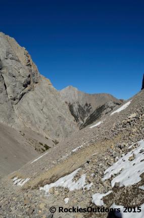
If you’re completing the loop as we did you’ll then need to descend down the other side of Cory Pass on a trail which goes over very loose scree (Parks Canada has a trail guide which gives a good description for this part of the hike). This part of the trail isn’t very clear so it’s a good idea to bring a detailed map with you.
When you’ve regained the well-built trail and it will level off a fair bit (though still has a couple of undulations), you’ll follow it around Mount Edith mostly through forest. However there are a number of scree slopes which you’ll cross offering views over towards Mount Norquay.
After a while the trail then begins to descend through dense forest and meanders around, continuing in a circuit of Mount Edith. The shade of the forest is a relief after the the haul up to Cory Pass. Eventually the trail will head back towards the Fireside Picnic Area where we started the hike. After this we had the short cycle back into Banff along the Legacy trail, we took our time and took some photos at the Vermilion Lakes along the way.
In all, the total distance for the loop is 13 kilometres (approximately 8 miles) and an elevation gain of 921 metres (roughly 3000 feet).
© RockiesOutdoors 2015.


These are fabulous photos and really great information! Aren’t we lucky to live next to this paradise?
LikeLiked by 2 people
Thank you! 🙂
LikeLike
Wow! That view from the top is amazing- well worth any effort to get up there.
LikeLiked by 1 person
Thank you! 🙂
LikeLike
Great views on this hike. Quite an elevation gain for 13 km only! 🙂
LikeLiked by 1 person
Yes, especially as the majority of the elevation gain is in the first 5.5km! 🙂
LikeLike
Wow very nice, you always have the best pics and information. Thanks for sharing
LikeLiked by 1 person
Thank you! 🙂
LikeLike
Great photos but I think the hike is a bit much for me. Glad you shared it.
LikeLiked by 1 person
Thank you! 🙂
LikeLike
Fab photos, so strange seeing it without the snow 🙂
LikeLiked by 1 person
Thank you! It’s always such a change between summer and winter 🙂
LikeLiked by 1 person
It looks very challenging :s
LikeLiked by 1 person
Thank you for reading! It was quite challenging…but we made sure to keep taking breaks along the way, I think we were running out of snacks on the way back though 🙂
LikeLike
I would love to do that kind of hikes, but I’m really not sure regarding my level of fitness 😀
LikeLiked by 1 person
I’m sure you could! 🙂
LikeLike